Trail Information
Trail Name: Weminuche Trail to Granite Lake
Location: Rio Grande Reservoir, Colorado
Date: July 10, 2015
Time at the Trail Head: 8:00 am
Trail Length: 2.7 miles
Elevation Gain: 3,740 feet
Elev. at Trail Head: 9,379 feet
# of Hikers Passed: 7
# of Mnt. Bikers Passed: 0
# of Horses Passed: 12
Mosquitoes: “thousands of them”
Trail Research
My research started out with trying to find a great trail somewhere in the middle of Colorado. I had been to Durango several times and I knew I didn’t want to be near any large cities, so my attention gravitated towards the area around the Rio Grand Reservoir.
I looked over topo maps and aerial images of the area and finally found a challenging trail that would take us on at least a 20-mile hike, but we would find out later, we had extended that by many more miles.

Drive to the Trail
As always, the drive to the Rio Grand Reservoir was incredible and everyone kept telling me to stop taking pictures of the drive.
We drove up through New Mexico and into Colorado (from Oklahoma) and headed west at Walsenburg, Colorado. The drive took us by the Spanish Peaks and past Blanco Peak just east of Alamosa. We drove through Creede and then to the Rio Grand Reservoir.
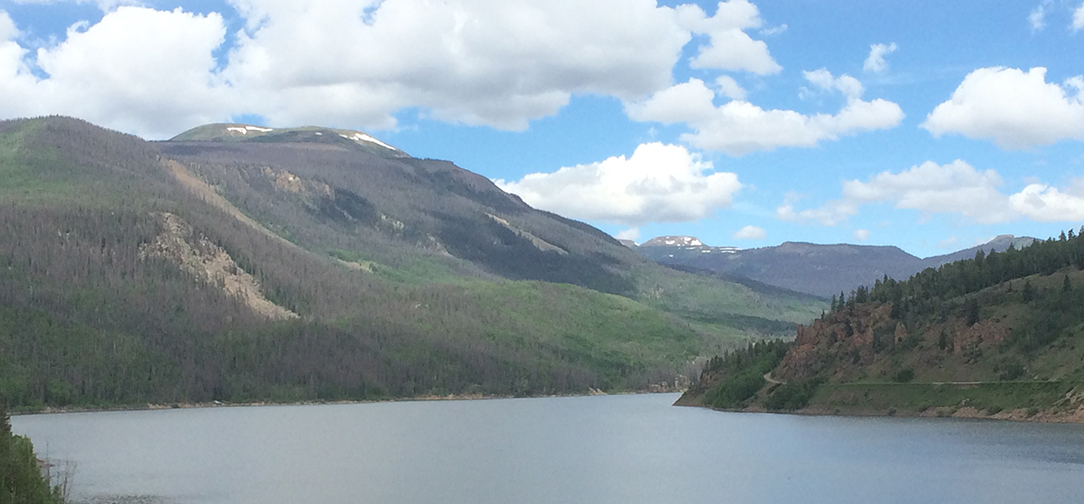
These two pictures above were taken on a different hike recently, but they are the mountains you would see on your drive from Walsenburg.
My Day on the Trail
We arrived late in the day on our first day there so we camped at the campground on the east side of the Rio Grande Reservoir at the Thirty-Mile Campground.
We noticed right away that the area looked like it had been devastated by a forest fire but it was beetle kill, which takes away from the beauty a little.
We headed up the trail along the reservoir for what seemed like 2 miles before turning south, to head deeper into the mountains. All this time we were being devoured by massive foot long mesquites (slight exaggeration).
The trail was steep but ran along a beautiful creek for many miles.
We were about to find out that it had been raining here a lot lately, hence the rushing creek.
As you can see, it’s beautiful, but you can also see that it is extremely wet, which we were about to learn firsthand how poorly prepared we were for the rainy conditions.

I have never been on a hike when it rained pretty much the entire time, and I was sure that wouldn’t happen here in Colorado, but we were about to find out that “I” was wrong.
We finally made it up the first steep section of the trail, coming from the Rio Grande Reservoir. A large high alpine meadow opened up before us and I was thinking things were starting to look better.
The photo below is looking back down the trail to the Rio Grande Reservoir.
We were exhausted by the long, steep, wet hike, all the while being eaten by mesquites, so we were glad when we finally reached our first camp site.
We were looking forward to a brighter, more dry 2nd day, but that was not in the forecast. As you can see, we woke up to rain, and as we were completely unprepared for significant rain, our cheap ponchos were just not doing the job.
We kept on going though and missed our turn off on the trail and added at least 4 miles to our hike, however, we did get a few nice photos.
We finally realized we took the wrong turn. We didn’t have satellite messengers at the time with topo maps that would have told us a little sooner that we were heading up the wrong trail.
We turned around and found the trail we should have taken and found out why we missed it. The Weminuchi River was flowing extremely full, which caused us to walk buy it, because, surely, no trail would cross that.
This river crossing was going to be a familiar ordeal throughout this hike. We didn’t have our Teva’s to cross the creeks in, so we would take off our boots, walk barefoot across the rocks, hoping not to fall in, and then dry off our feet with the one and only towel we brought on the trip, and it wasn’t a quick dry towel either.
There were beautiful areas of the trail and hike as you can see below, but…
…we were about to find out why hikers don’t like to hike on trails that people use to horseback on, especially in wet weather.
I want to go on record here and tell all of you, that I absolutely love horses, BUT, I hate hiking on trails they use.
Oh, Wait… Here’s a better trail photo of what these wonderful, magnificent horses put us through.
I love em but I hate them!
We finally reached Granite lake, after an extremely difficult hike up a steep trail and a rock field. It would have been more impressive if the weather was better.
We settled in for another cold evening.
I forgot to tell you about our mosquito problem, but this one deals with mesquites when trying to go to the bathroom, but let’s not go into details here.
Let’s just say that this is the one hike we love to hate, and it’s hard to say that about a hike in Colorado.
The main reason we hated it so much was that we really were not prepared properly for the wet weather, and this hike changed that for us. We now have great waterproof gear for us and our packs.
Trail Recommendations
This is a challenging trail because there are steep sections, with a lot of mesquites, and it’s no fun when it rains, due to the horses. Always check to see if the trail is used a lot by people with horses.
Lessons Learned
Proper Gear is the phrase for the day. Make sure you are covered from your head to your toes with quality rain gear, and don’t forget a rain cover for your pack or dealing with rain at your campsite.
- Premium efficiency and design
- Storage tuned to the each season
- Purpose designed to help mak the most of each exploration
- Packs Into Its Own Carry Case
The Teva’s below are great for using when crossing streams that are too much for your waterproof boots.
- Water-ready polyester webbing stands up to the elements and dries quickly after getting wet
- -EVA foam footbed cushions and softly supports for all-day comfort
- Footwear Sizing Guide : Draw a straight line, longer than your foot, on a piece of paper. Place the paper on a flat surface. Stand on the line with your heel and longest toe centered on the line. If measuring a child's foot, it may be easier to hold the paper up to their foot. Place a mark on the line at the tip of the longest toe and at the back of the heel
- Repeat steps 1-3 for the other foot. Measure the distance between the marks. Taking the larger of the two measurements, use the conversion chart to find your correct shoe size
I would love to know if you have had any experience on this trail or have other trails you love to hike. Leave a Comment Below or send me an Email.
Return to Home Page


Hey Rick Thanks for sharing these trail research about trails in Colorado. From your research I found out Colorado is a nice place to be on vacation hiking and camping. Thank you so much for your trail review. You should also think about hiking in Slovenia and I’m sure it will be nice to carry out your trail research there. Thank you.
Thank you for the comments and compliments.
I will take a look at hiking in Slovenia.
Rick
A great post Rick. I loved all the photos and really felt like I was with you on this trail. The photos are absolutely stunning and the description you gave really helped put those pictures in perspective (“thousands of mosquitos”).
I loved the part about the horses using the trail, and as someone who’s still very much a beginner to trail hiking I can see why! Is there any other type of animal that would destroy the track like that? Also what was the temperature that you were hiking in?
Once again a great post and can’t wait to see where you trek to next.
I love horses but they can create havoc on a trail when it’s raining. The only animals that can do more damage to a trail is a bear, mountain lion or a moose for different, dangerous reasons.
We made this hike in July and it is normally very warm in Colorado then, but the clouds, wind and rain made it more like 40 or 50 degrees F.
Rick