Trail Information
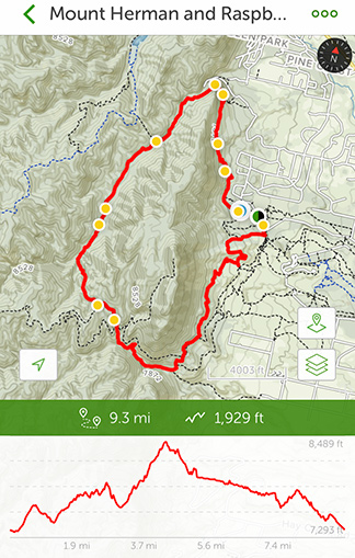 Trail Name: Mount Herman and Raspberry Mountain Loop
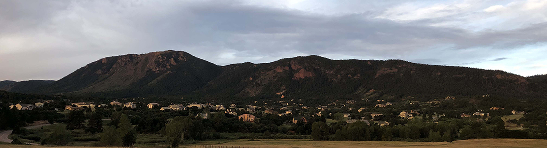
Location: Near Palmer Lake and Monument, Colorado
Date: September 7, 2019
Time at the Trail Head: 7:00am
Trail Length: 9.3 miles
Elevation Gain: 1,929 feet
Elev. at Trail Head: 7,293 feet
# of Hikers Passed: 19
# of Mnt. Bikers Passed: 13
# of Horses Passed: 0
Mosquitoes: 0
My Day on the Trail
I decided to look for a hiking trail between Denver and Colorado Springs with a decent length and moderate rated trail. I finally settled on the Mount Herman and Raspberry Mountain Loop trail that sits in between Lake Palmer and Monument, just north of Colorado Springs.
The trail started out (clockwise) and was a little disappointing. The weather was great and it was about 65 deg. F when I started off but the hillside had been decimated by a fire in the summer of 2011.
Click HERE to see a short video of the fire from Monument. The hillside has grown back with a lot of scrub oak and the trail is not well maintained. This part of the trail was difficult to stay on as it is not well traveled these days.
I lost the trail several times and had to walk up the gravel road for at least a half mile until I could find the trail again. Most people take a short trail to the gravel road and walk up the road for about a mile before reaching the well maintained trail. I also had to do this and it is annoying to be passed by about 20 vehicles when you’re expecting to be on a beautiful trail in the Rockies.
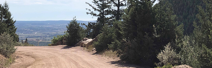
I finally found the main trail and things started looking up after that. This part of the trail is well maintained and it is moderately traveled. I passed about 19 hikers and 13 mountain bikers over the 9.3 miles and that is pretty light for that distance. It probably helped that I was out early in the day and in September when most of the tourists have left the state due to the kids all needing to be back in school.
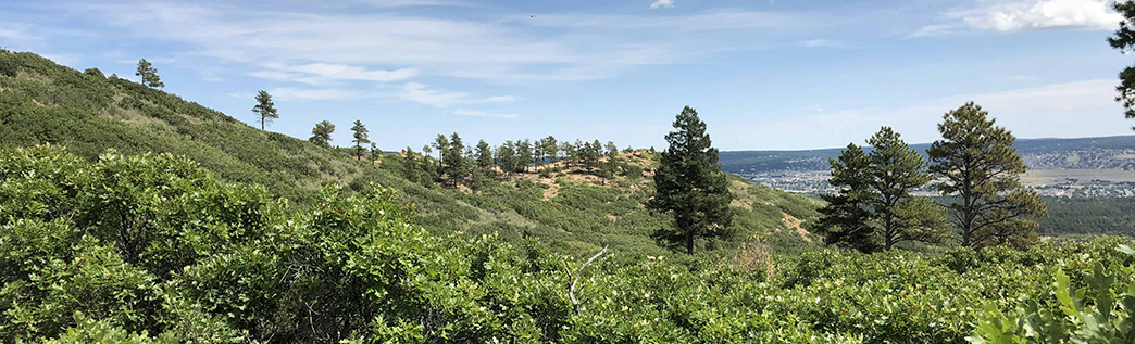
This section of the trail is on the back side of Mount Herman (west side of the mountain) and is the most difficult part of the hike (considering elevation change). It is actually a beautiful hike even though there were not as many places I could see long distances for some great photos. I was in the woods for a majority of the hike. There was a small creek that parallels the trail heading to the north but it wasn’t flowing full and it was easy to cross the few stream crossings I came across.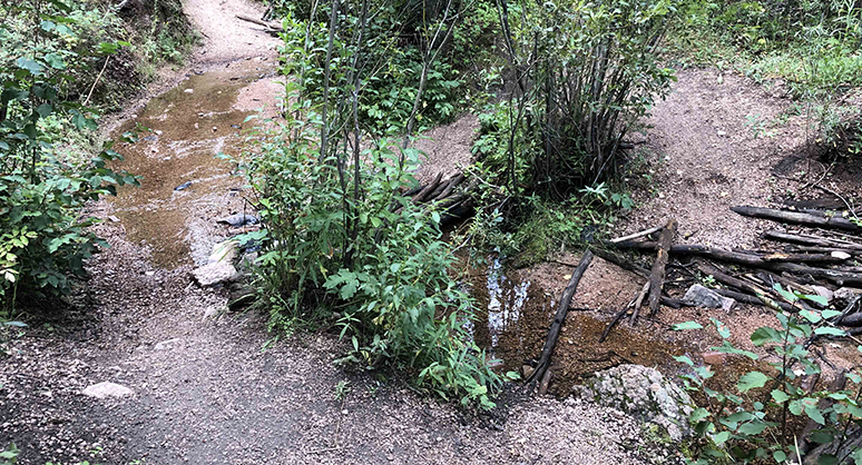
This part of the trail saw the least amount of traffic and there were several times that an hour or so went by and I hadn’t seen anyone. I don’t mind hiking alone, especially when there are some hikers around and that brought me back to my research that I have done lately on Hiking Emergency Beacons, which are called Personal Locator Beacons (PLBs) and Satellite Messengers. It was on this back stretch that I was thinking it would have been a great idea to have an emergency locator with me. I have heard to many stories, some including experienced hikers, that have ended up in tragedy and may have ended up different if there was a way to call for help.

- SYNC WITH BLUETOOTH: Connect to SpotX to cellphone so you can communicate with family or even search and rescue; Use as a standalone communication device with it's own dedicated US mobile number to receive messages
- PEACE OF MIND: Send S.O.S. to 24/7 Search & Rescue service, message back and forth about the nature of your emergency, receive confirmation when help is on the way; Message any cell number or email address virtually anywhere
- GLOBALSTAR SATELLITE & SPOT products use GPS to determine location and transmit GPS coordinates to others; SPOT users can notify friends, family or emergency rescue their exact GPS coordinates
- WHAT'S IN THE BOX: SpotX Device, strap and carabiner, micro usb data/power cable, quick start guide, SOS mirrored sticker, warranty card and kickstand
- PURCHASE, ACTIVATE, EXPLORE: Grab a Spot X 2-way Satellite Messenger; Activate by selecting your service plan; Get out there and explore the world with peace of mind
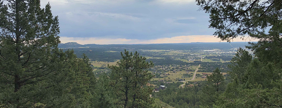
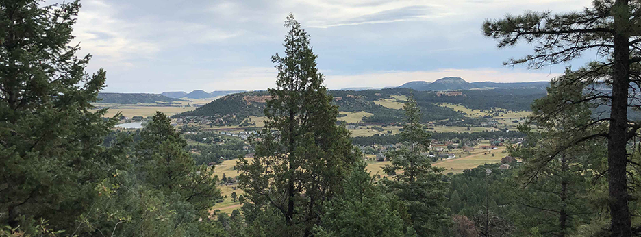
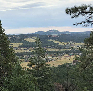
I finally made it around to the north side and then started heading back to the south. This area had some beautiful views but they were of the east side of Mount Herman which is looking out over Lake Palmer, Monument and I-25 in the distance, so it’s not as beautiful as I would like.
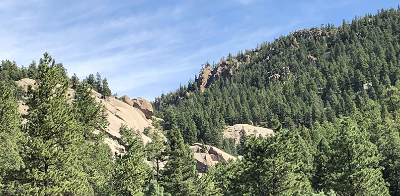
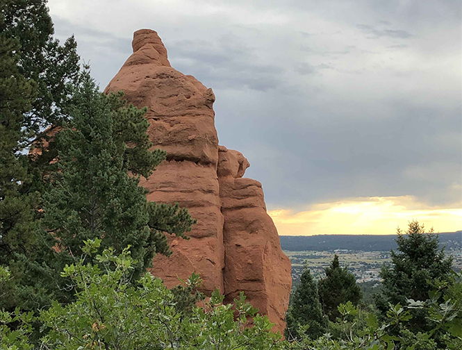
There are also a few spectacular photos of rock out croppings along the way.
Trail Recommendations
 One thing that is always great about hiking in the Rocky Mountains is that there is rarely a bad trail and hardly ever a bad day when you get to spend time outdoors. There were many times on this hike where I just stopped and breathed in deeply, that fresh pine scented mountain air. That is just something I will never get tired of.
My recommendation is that you should go ahead and hike this trail if you’re in the area. It is easily accessible from Colorado Springs and it’s not a hard hike, if you’re used to the altitude.
Would I recommend this trail to others? Yes, but will I ever go back to this trail? No. There are so many other incredible trails in Colorado that I have not hiked yet and this one does not rank high enough for me to want to revisit.
If you would like additional information or to see the Personal Locator Beacons (PLBs) and Satellite Messengers, go to my REVIEW PAGE, leave a COMMENT BELOW or send me an EMAIL.
Return to Home Page
Mount Herman Loop
Pros
- Easy Access
- Easy to Moderate Trail
- Nice Scenery
Cons
- Difficult to Find Trail at Times
- No Significant Mountain Views
- Not Much of a Stream
- Hike on Gravel Rd for 1/2 Mile
Fresh mountain air is great, and if it is associated with a scenic trail, it is even better. But it is sad that the Mount Hermon loop trail is sometimes difficult to find as the trail is not well maintained at the start and that you have to share the gravel road with vehicles on occasion.
Thank you for the recommendation that you will hike the trail if you are in the area, but it might not be worth a long drive to do it.
There are so many trails in the area that you wouldn’t have a hard time finding another trail. This may be a great trail if you are in good shape and use to the altitude. I also saw that it would actually be good for mountain biking, and I passed several mountain bikers on the trail.
There is a shorter trail that goes up to the top of Mount Herman, which would be better and have some outstanding views of the area. That I would recommend trying, and I guess I need to put that on my list to do.
Rick